Town Founders and the layout of Dicksonville, now Dixon
Thomas Dickson, John S. Mayes, Peter N. Peters, and Henry A. Ross

Four original pioneers and their families generously donated the initial land for their vision of a newly established town of Dicksonville. Notice the spellings of each map originally filed. The first store was opened in 1868 when the train tracks were finished. 4 years later, when Thomas Dickson and Peter N. Peters filed their maps, it had not yet been agreed on how the town should be named or spelled.
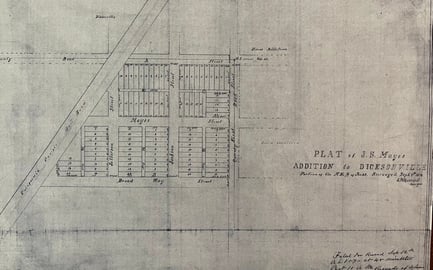
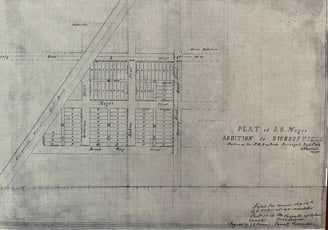
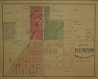
The Map of Mayes Addition to Dicksonville was filed on September 12, 1870 by J.S. Mayes. This land was originally owned by William and Catherine McKinley, as well as the land where the Silveyville/Dixon Cemetary is now located. J.S. Mayes also later filed another map with lots and land south of Broadway to Cherry Street (in the 1878 map see how it has changed...light orange color)
Peter N. Peters’ Addition to the town of Dixon was recorded on March 21, 1872. (in the 1878 map see how it has changed...yellow color) In the 1878 map you can see that NBS Coleman and WR Ferguson later bought 40 acres of land from Peter N. Peters adjoining the map he filed, which was still undeveloped and the two partners Coleman and Ferguson later sold these lots, including what is now known as the Dixon May Fairgrounds.
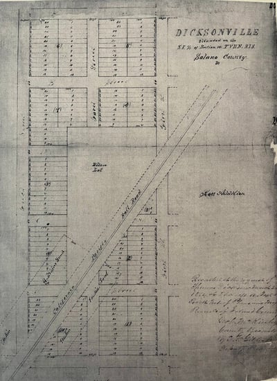
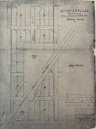
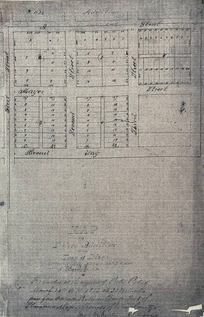
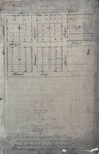
The map of Dicksonville was recorded on March 26, 1872 by Thomas Dickson. (in the 1878 map see how it has changed...pink color)
The area labeled as "Haskins Land" (later known as "The Haskins Tract") and all the dashed areas are the 10 acres of land Thomas Dickson donated to the California Pacific Railroad for a depot and town purposes for the railroad right of way and the depot that was supposed to be named after himself. His great grand-daughter wrote in an article to the Dixon Tribune in 1968 that when he knew the depot sign and literature was spelled wrong, he said to "let it stand". However, with this map filed in 1872, he obviously still wanted the town to be known, as the original settlement of pioneers here knew it before the train came through, as Dicksonville. In the 1878 map, the Haskins Tract now belongs to Thomas Dickson's son in law, DB Huff.
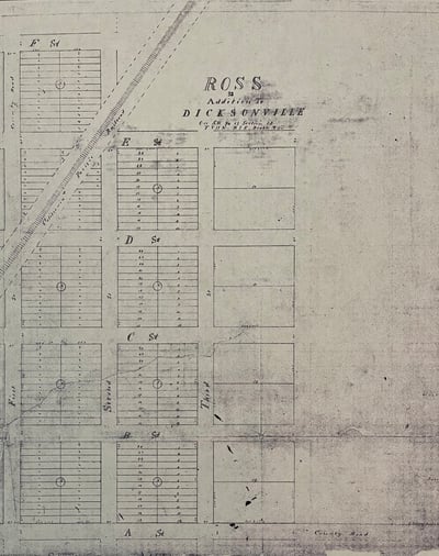
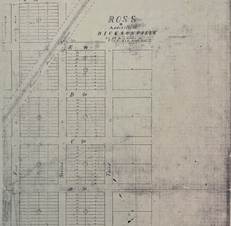
H.A. Ross’s Addition map to Dicksonville was filed but does not contain a date. (in the 1878 map see how it has changed...light green color)
The center of town was the intersection of First (Main) Street and A Street, where all 4 Additions connected. See the X on the colored map. All streets were set in a north/south, east/west configuration.
Unfortunately the spelling error by one or more California Pacific Railroad employees changed the fate of the town name in 1868 when literature was printed for timetables and a sign was put up on the new train depot and station, donated by Thomas Dickson, but spelled "Dixon".
All four maps where combined when the town was incorporated in 1878, as shown on this map of the town of Dixon from the Historical Atlas of Solano County in 1877/1878, courtesy of Alan Schmeiser, showing how the town decided on its spelling. It also shows the prominent buildings and the land owners at the time.
These original filed maps are what we have had to use to determine who owned property through the years. Each map is an "Addition" and they each have blocks numbered and lots numbered within each block. When there was a real estate transfer or purchase, if it was within the city limits, the land would be described and a deed filed with Solano County. If we were lucky they would have written the description as "lot 5 in block 1 of Peters' Addition to the Town of Dixon", or "lot 2 of block 5 of Ross' Addition to the Town of Dixon". Many times we were not so lucky and it would be described in feet and directions from someone else's property at the time of the land transfer. Unless there was a map that showed who owned the property at the time, it was a puzzle to figure it out.
The same happened downtown. As there were no addresses until about the 1920's, everything would be described in relation to the buildings that everyone knew, especially the post office. However, prior to the first post office building being built in 1908, the post office was located in the business owned by the Postmaster. The businesses changed locations often as well, physically by moving the actual building to a different location or moving the contents from one location to another. It has been a time consuming, on-going puzzle to figure out who and what business were in each historic site of the downtown.